Chapter: Chosen Again

Information relevant to the 10th chapter of Dragon Fire
the cothon
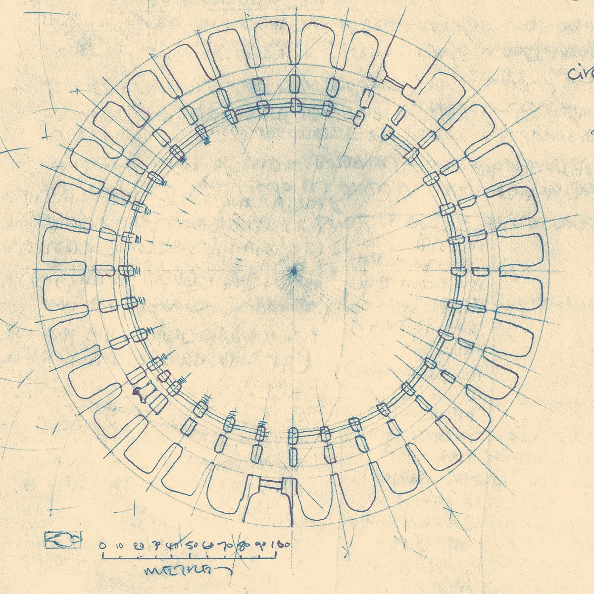
The first diagram shows a plan of a typical cothon. Around its edge are the deep vaults in which the dragon ruhuimur are stabled. Within this are two further rings, of piers. The innermost one is where the dragon towers proper are stored. The ring between this and that of the vaults is where the tower bases are stored. The two major components of each tower are suspended upon beams and rigging above the gaps in between the piers, to allow a dragon—moving from its vault towards the centre of the cothon—to pass beneath each tower component. As the dragon does so, the tower components are lowered on to it and, as the monster’s strength returns after its period of sleep, its tower is assembled on its back
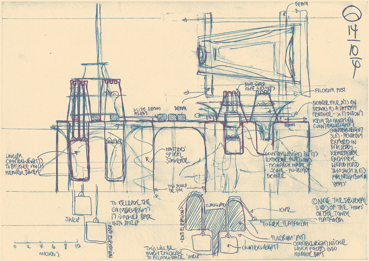
The diagram above is of a pair of piers as viewed from the side (with the centre of the cothon to the left, vaults to the right). The rough outline of a dragon can be seen standing beside the right pier; it is waiting for the tower base shown above (and in plan in the expanded version of the diagram) to be lowered first onto its back. Later it will move towards the left, beside the second pier, where the truncated pyramid of its tower proper will be lowered and joined to the tower base
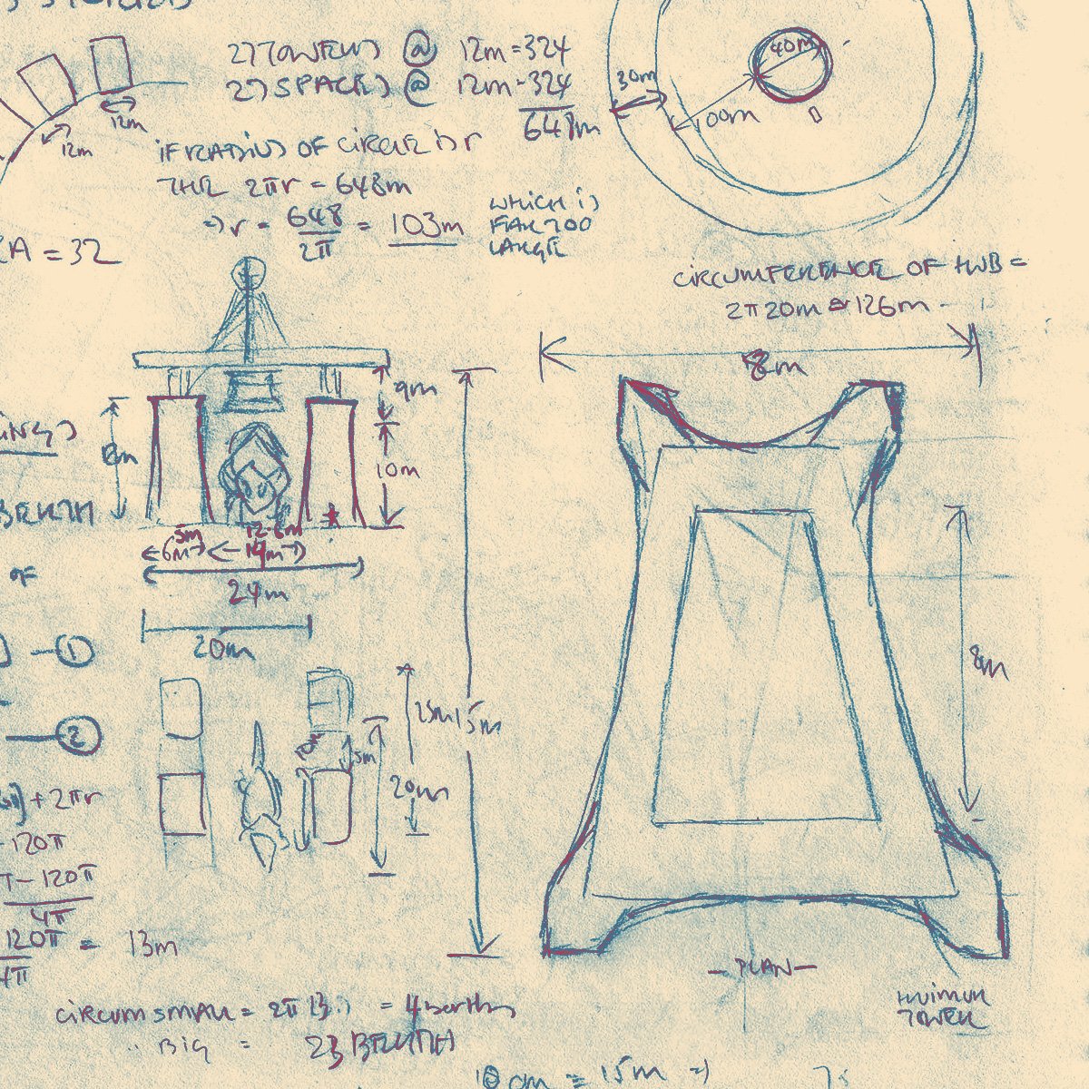
The final diagram shows my initial exploration of the cothon mechanisms. The shape on the right is a tower base seen from above, tapering towards its front. The top left shows a pair of piers with a dragon between them facing us, a tower ‘pyramid’ suspended above it. The bottom left shows the same dragon from above between the two inner piers
Qunoth
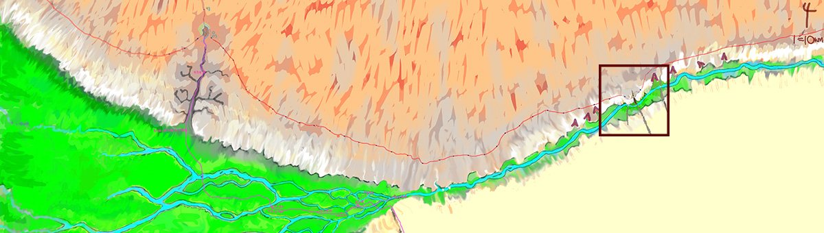
Qunoth – coming originally from Quyan keyu meaning ‘seven’ and noth meaning ‘ladder’ – refers to its position controlling the seven passes marked on the map above as purple chevrons. (The square frame marks the area depicted in the expanded version of the 2nd image)
The second map shows Qunoth (the long red structure)—looking a little like a cuttlefish – extending as a blade of rock from the Guarded Land plateau – its fissured limestone being shown in white. The Qunoth rock is part of a vast basalt dyke (that can be seen better on the expanded image) that the Gorge river breaks through far below —the floor of the Gorge is shown in green. The Ringwall road is the pale brown thread passing across the northern edge of the city. Its leftway—shown in blue—separates from it, does a circuit of the city, and returns to join the road. Top left, on the other side of the raised road, are the shanties spreading off into the interior
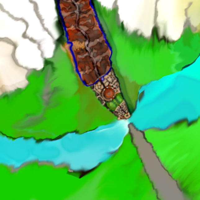
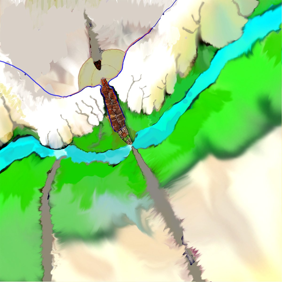
The third diagram shows the part of Qunoth that extends out high above the land below. The orange region (towards the top left) is the Midden. The dark red areas are the tenements of the city, the pale threads are roads. Fort Street runs down the spine of the city towards the gate—shown as a red dot—of Qunoth’s legionary fortress. Southwards, beyond this, are the paler legionary barracks and stables. The ‘red eye of the cuttlefish’ is the cothon. The green region beyond is parkland and the pale triangle on the other side is the sanctum. The pale tip is the tower of the Legate of Qunoth that stands above the white threshing falls far below