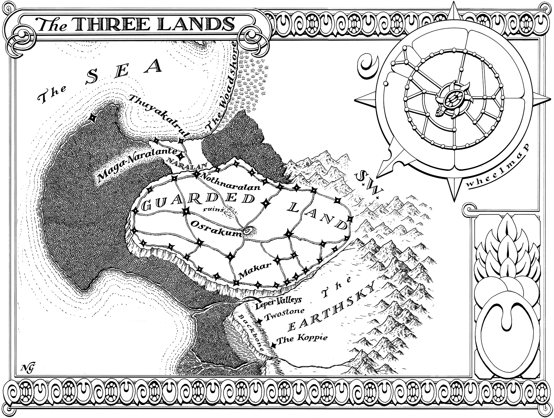
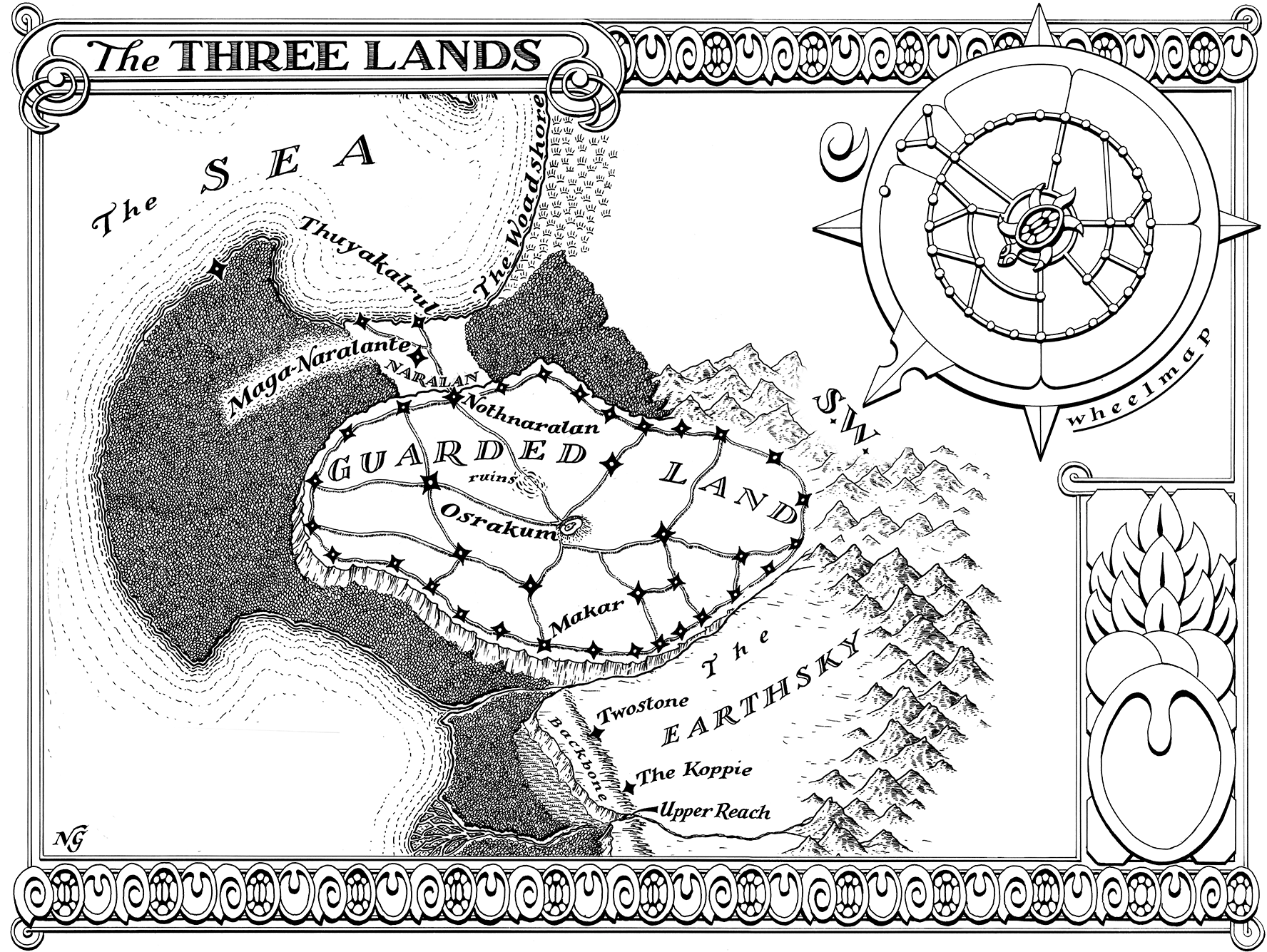
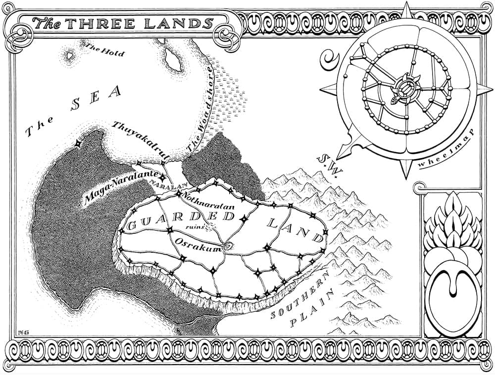
Three Lands Map for Book 2
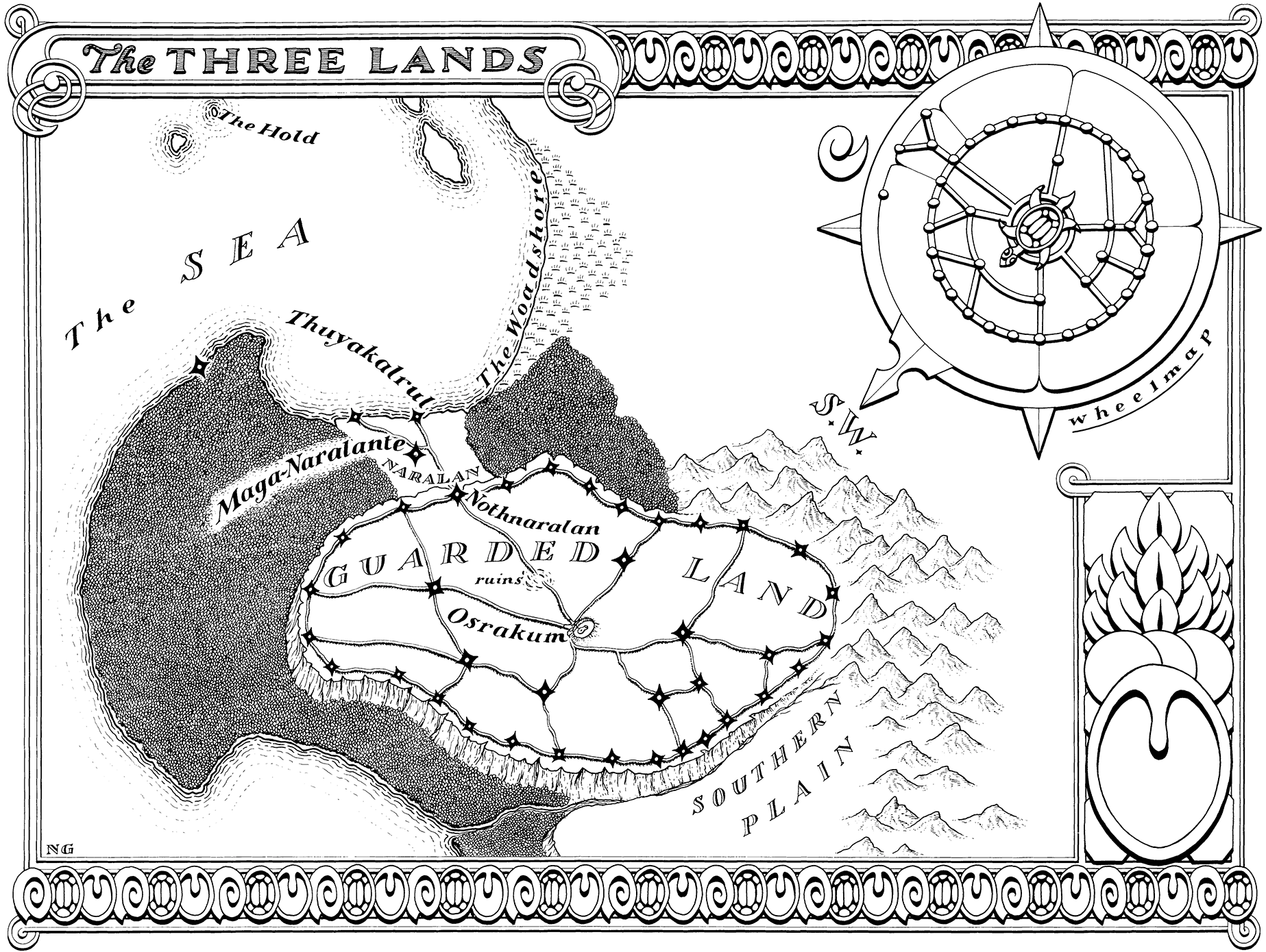
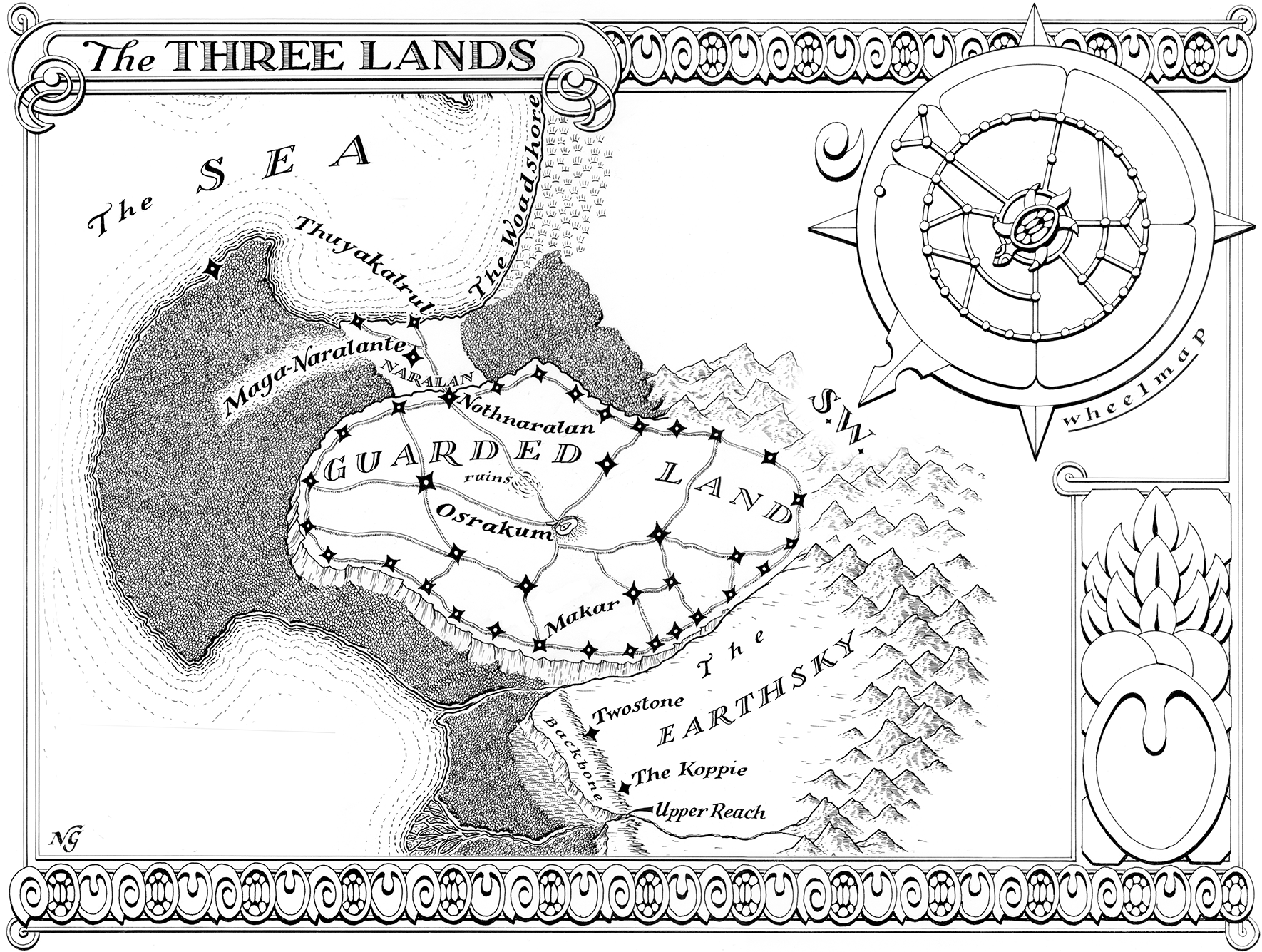
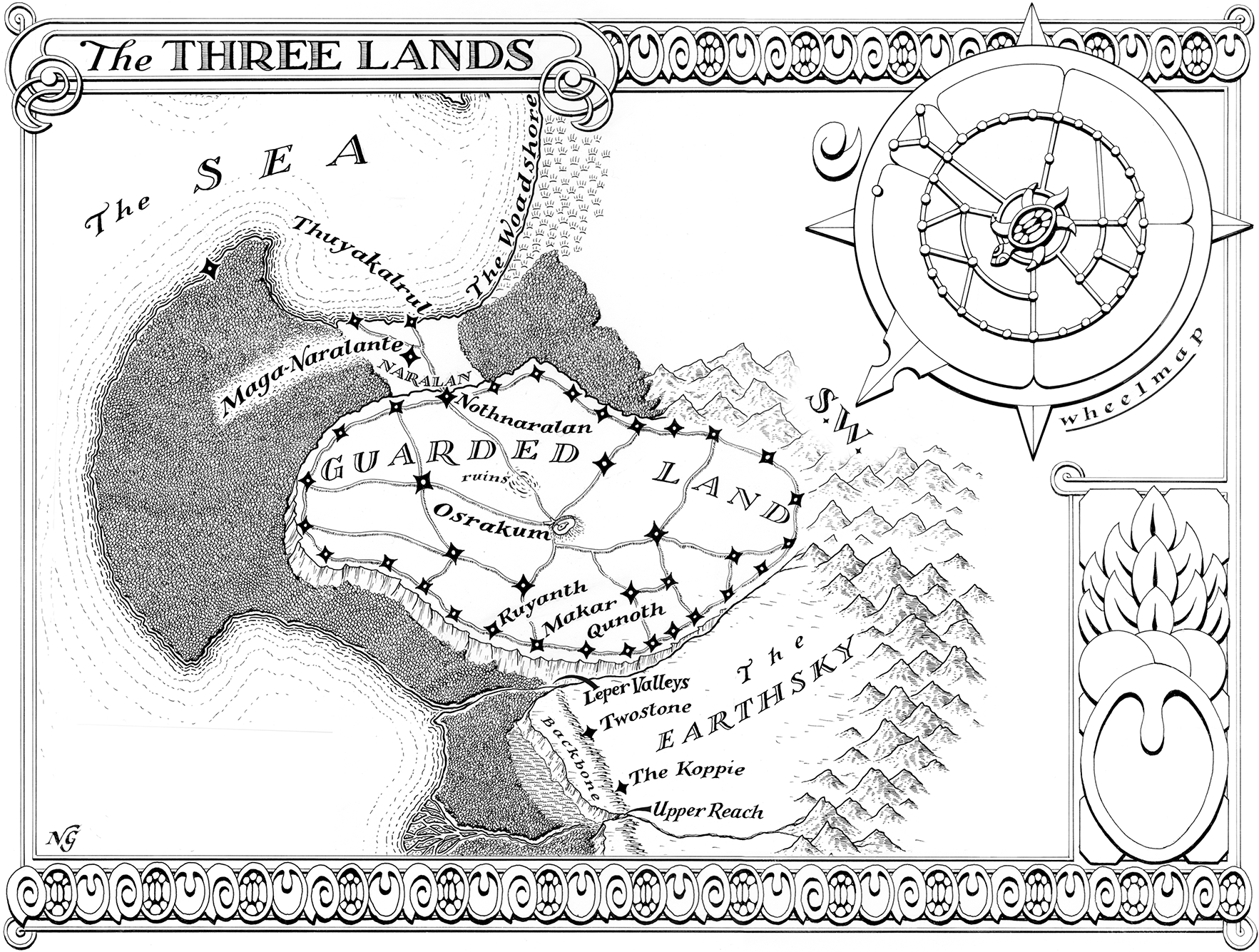
first image was scanned from my most recent copy of a KDP published book: the second image was scanned from a previous copy of the same KDP published edition
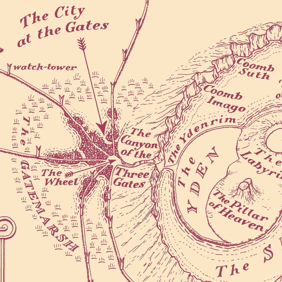

The City at the Gates is so named because it lies at the gates of Osrakum. Built on land reclaimed from the Gatemarsh, it has at its heart the great market of the Wheel, from which the five raised roads radiate out like spokes across the Guarded Land. The habitations of its almost three million citizens spread out along the causeways that carry the roads with their watchtowers
From the Wheel, the Canyon of the Three Gates leads into the crater of Osrakum
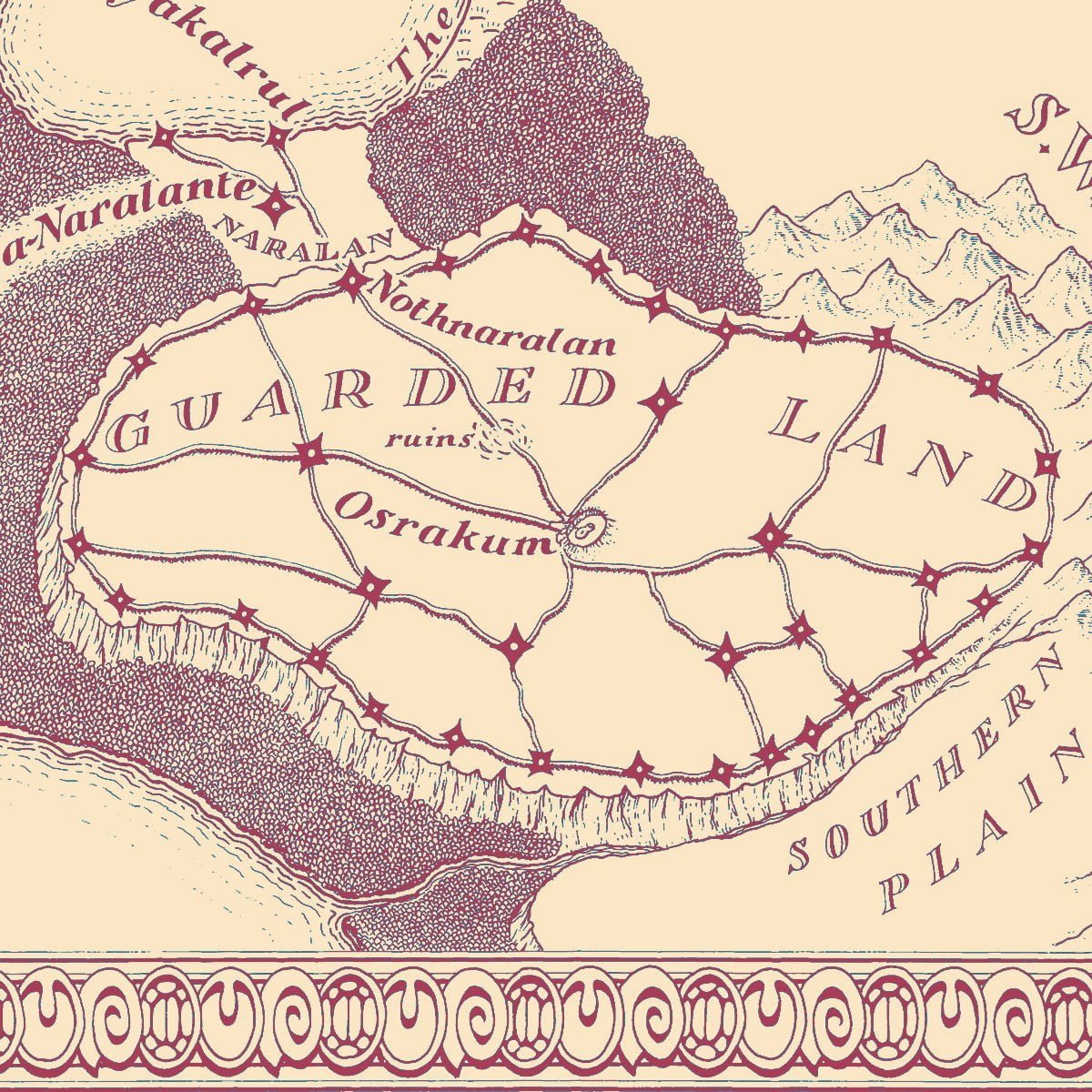
This detail of the Neil Gower map shows the Guarded Land plateau, with the Osrakum caldera at its heart, and shows the network of raised roads with their watchtowers. The road that runs around the edge of the plateau links cities—such as Nothnaralan and Makar—into the defensive system called the Ringwall. Each city is garrisoned by a legion; the cities in the interior are each garrisoned by two. The greatest city of all is the City at the Gates, lying as it does at the convergence of the road system just to the west of Osrakum. A network of tracks grids the whole of the Guarded Land; at every intersection of these tracks is a sartlar kraal
Nothnaralan is Quyan for ‘the ladder to the sea’. This city was built by the Chosen as part of their conquest of the Naralan
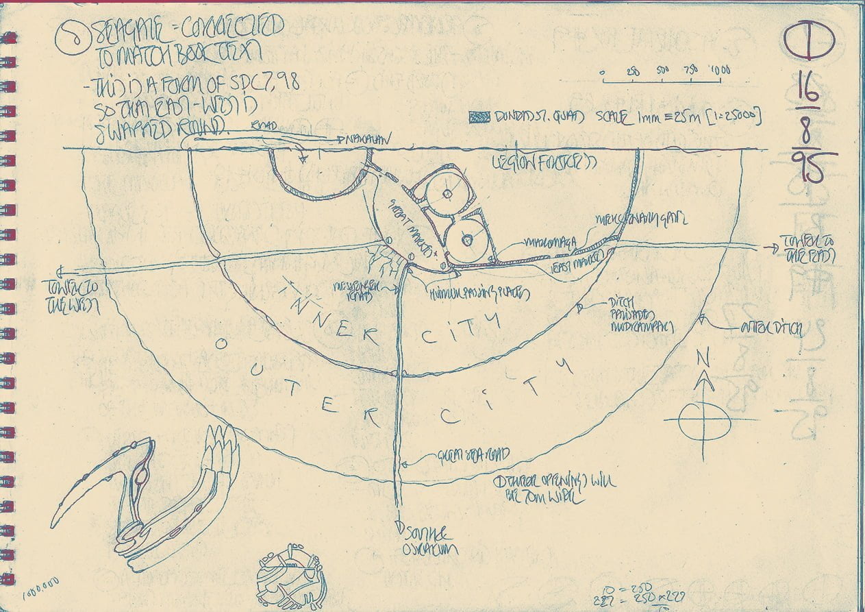
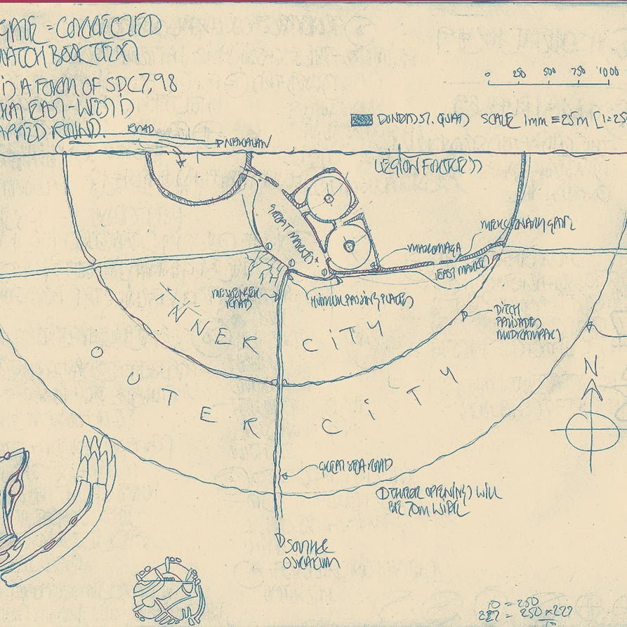
This is where Carnelian and his companions come up onto the Guarded Land. It is in the semi-circular space, against the cliff edge, that they make their camp for the night.